

High-tech forest maps predict the ecological traits of Amazon birds
New research led by The Australian National University (ANU), in collaboration with Arizona State University (ASU), has used high-resolution remote maps of the functional diversity of Peru’s forest canopies to predict the ecological strategies of the birds living within them.
Traditionally, scientists have relied on broad environmental metrics, such as elevation, climate, and overall forest cover, to model bird biodiversity. However, this approach often treats large, contiguous forest blocks as uniform, overlooking the fine-scale canopy variations that shape local resource availability.
By analysing more than 1,300 forest-dependent bird species across the Andean-Amazonian landscape, the interdisciplinary team demonstrated that distinct forest functional groups (clusters of trees sharing similar chemical and structural properties) support bird assemblages with different traits, life histories, and evolutionary lineages.
Lead author Dr George Olah, a DECRA fellow at the Fenner School of Environment and Society at ANU, said the findings highlight the critical link between a forest’s canopy and the animals that depend on it.
“From a standard satellite image, a massive block of Amazonian forest might look like a continuous, uniform sea of green,” said Dr Olah.
“But by linking newer high-tech maps of the chemical and functional traits of the forest canopy to avian ecology, we demonstrated that the composition of the trees exerts a big influence on the life-history strategies and vulnerabilities of the bird communities living there.”
The researchers found contrasts between distinct forest types. For example, lowland Amazonian floodplains were found to support assemblages dominated by small, fast-reproducing songbirds. In contrast, the chemically distinct northern swamp forest canopies uniquely support large-bodied, slow-reproducing, and evolutionarily distinct bird species.
This trait-based framework offers a powerful new tool for conservation, specifically for conducting gap analyses.
If conservation networks prioritise areas based solely on total species richness or generic tree cover, they may inadvertently protect resilient floodplain forests while leaving the functionally unique, large-bodied assemblages of the swamp forests unprotected.
“By combining advanced airborne imaging spectroscopy with ecological data, we aren’t just mapping where the trees are; we are mapping the composition of the canopy itself and how the ecosystem functions,” said co-author ASU professor Greg Asner, whose team developed the Amazon canopy maps. Asner is director of the ASU Center for Global Discovery and Conservation in the Julie Ann Wrigley Global Futures Laboratory.
“This approach provides a scalable way to identify distinct conservation risk profiles across different forest types, providing explanatory power far beyond traditional forest maps.”
With new satellite-based imaging spectroscopy missions coming online soon, this proof-of-concept study could soon be expanded to support biodiversity monitoring across the entire Amazon Basin.
“By integrating habitat functionality with species traits, we can revolutionise conservation planning at the landscape scale,” said Dr Olah.
“Mapping the biological and functional diversity of the Amazon canopy is essential to safeguard the full spectrum of avian ecological roles, preventing the silent loss of animals as the forest is either protected or deforested,” said Asner.
The study is published in Nature Communications https://doi.org/10.1038/s41467-026-77135-6
Related articles
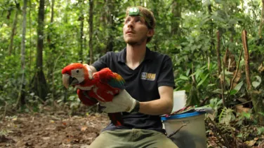
Dubbed "CSI, but for parrots", Dr George Olah is creating a forensic genomic toolkit which will help authorities to track the routes of illegally traded birds poached from the wild in Indonesia.

Researchers have mapped the hidden routes of Mexico's illegal parrot trade, using almost 30 years of data to predict trafficking hotspots.